We arrive in Zion late, about 10 pm. So, we don’t see anything on the drive or in the RV park. Which makes waking up a bit of a surprise. Here’s the view that we awake to:
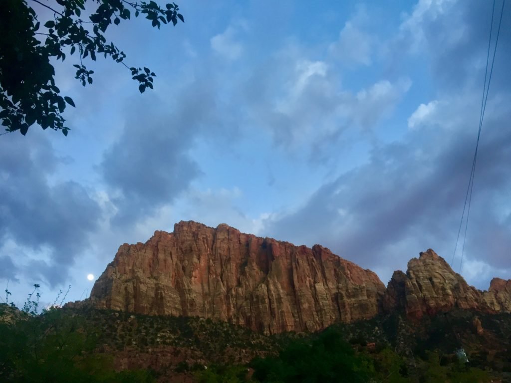
Wow!!
There’s a trail called Angel’s Landing that is one of the most popular walks in Zion. But it doesn’t suit the tingling feeling I get around big drops (in parts the trail is very narrow with 1000-foot drops either side). But there is a longer trail that Angel’s Landing branches off that we have planned to walk instead.
It is possible to do this trail (called The West Rim) in one direction but it’s a pain to get to the trail head.
So, we decide to hike to a point and retrace our steps. The guide we read said the West Rim was seventeen miles and that the first six or so were fairly plain. Our goal then it to reach Cabin Springs which by my reading makes it about eight miles each way. But when we get to the visitor centre, they say it’s more like five miles each way, and that it’s one of the best views. Perfect!
We get a shuttle to The Grotto stop, with all the Angel’s Landing people and start our ascent
It starts a little steep and only gets steeper. But the views are amazing, even on the kind of ‘access’ parts of the trail.
It also gets clearer that we don’t want to be on Angel’s Landing with most of these people either. They are the kind of obnoxious get-a-photo-in-a-dangerous-spot-so-it-looks-like-I’m-the-only-person-here for Instagram risk takers who must occasionally die for their efforts. I don’t want to be the collateral damage, or witness their inevitable demise
Which makes a wonderful relief when we get to the Angel’s Landing spur, rest a while, and let those idiots pass us
Meanwhile we start seeing a couple of large birds soaring over us, a welcome distraction indeed. As we look and chat with an older couple we conclude that they are condors — badass!
We set to hiking the rest of our route. Which offers us very cool views of Angel’s Landing, it looks like a smaller peak connected to a much larger peak by a saddle, all overlooking the canyon below. It is pretty cool, though I’m happy looking on from afar.
As we climb, we get better looks at the condors roaming about the skies above us, and sometimes swooping in lower over around us
The trail goes up and down and around and on and on, offering ranging views of giant red cliff and grey slabs of rock (a lot like Elephant’s Hide in the Grampians)
As we go on well past the five mike mark, we encounter some girls coming the other way who says it’s about another three miles to the springs. I suppose I was right, eight miles each way.
There are interesting features in the cliffs above use: a red eye shape where the grey rock has fallen away and exposed the red rock beneath. And a small ridge on the opposite cliff where there’s just enough space for a line of trees, then the cliff continues up from the ridge towering over the trees
The final couple of miles are long switchbacks and it’s weird to look at these features at eye level, since moments ago they had been so far above.
Finally, we reach the top and can look out over the canyon. It’s spectacular and it’s also lunchtime(!)
The walk back is uneventful, but beautiful the whole way.
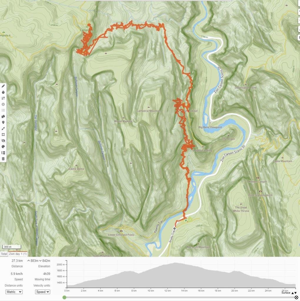
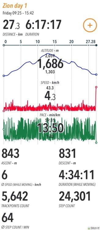
By the ends it’s been about a 27km walk with about 3500 feet elevation. Ready for a rest and then bed!


Walk summary: